Carregar apresentação
A apresentação está carregando. Por favor, espere

1
INFRASTRUCTURE DEVELOPMENT IN THE CITY OF SÃO PAULO
Vanessa Meloni Massara Civil Enginerring, Master in Urban Engineering Polytechnic School – University of São Paulo 2002 Notes: 1. Figures without scale 2. Here the distinction between "maps" and "figures" is necessary. In simple terms, the "maps“ are accurate, having a reference and at worst a simple graphical scale. "Figures" as elaborated in this work only indicate generic spots that respect a certain degree of accurately but can not be used as basis for detailed studies.

2
INTRODUCTION In general, the implementation of infrastructure begins at the old location of the city and ends up constituting the "center". The natural direction of evolution considers this milestone and from it the technical facilities of extension pipes (eg topography), the cost of each service (which explains why the electricity and water supplies arrive before collector sewer) and population concentration generated by the history of creation and development of the neighborhoods around the starting point of the city. In this study, we found (as shown in figures) that the installation of services began in the central area of the city, extending approximately concentrically around this first center, covering the region now called for expanded center. After the 70th the implementation is consolidated at the periphery of the city, mainly in the southern and eastern areas, the least served.
, the cost of each service (which explains why the electricity and water supplies arrive before collector sewer) and population concentration generated by the history of creation and development of the neighborhoods around the starting point of the city. In this study, we found (as shown in figures) that the installation of services began in the central area of the city, extending approximately concentrically around this first center, covering the region now called for expanded center. After the 70th the implementation is consolidated at the periphery of the city, mainly in the southern and eastern areas, the least served.")
3
WATER SUPPLY

4
1900

5
1928

6
1958

7
1975

8
1995

9
2000

10
Layers with districts

11
Layers

12
SEWER COLLECTION

13
1900

14
1928

15
1958

16
1975

17
1995

18
2000

19
Layers with districts

20
Layers

21
PUBLIC LIGHTING

22
1900

23
1958

24
1975

25
1997

26
Layers with districts

27
Layers

28
GAS

29
1958

30
1975

31
1999

32
Layers with districts

33
Layers

34
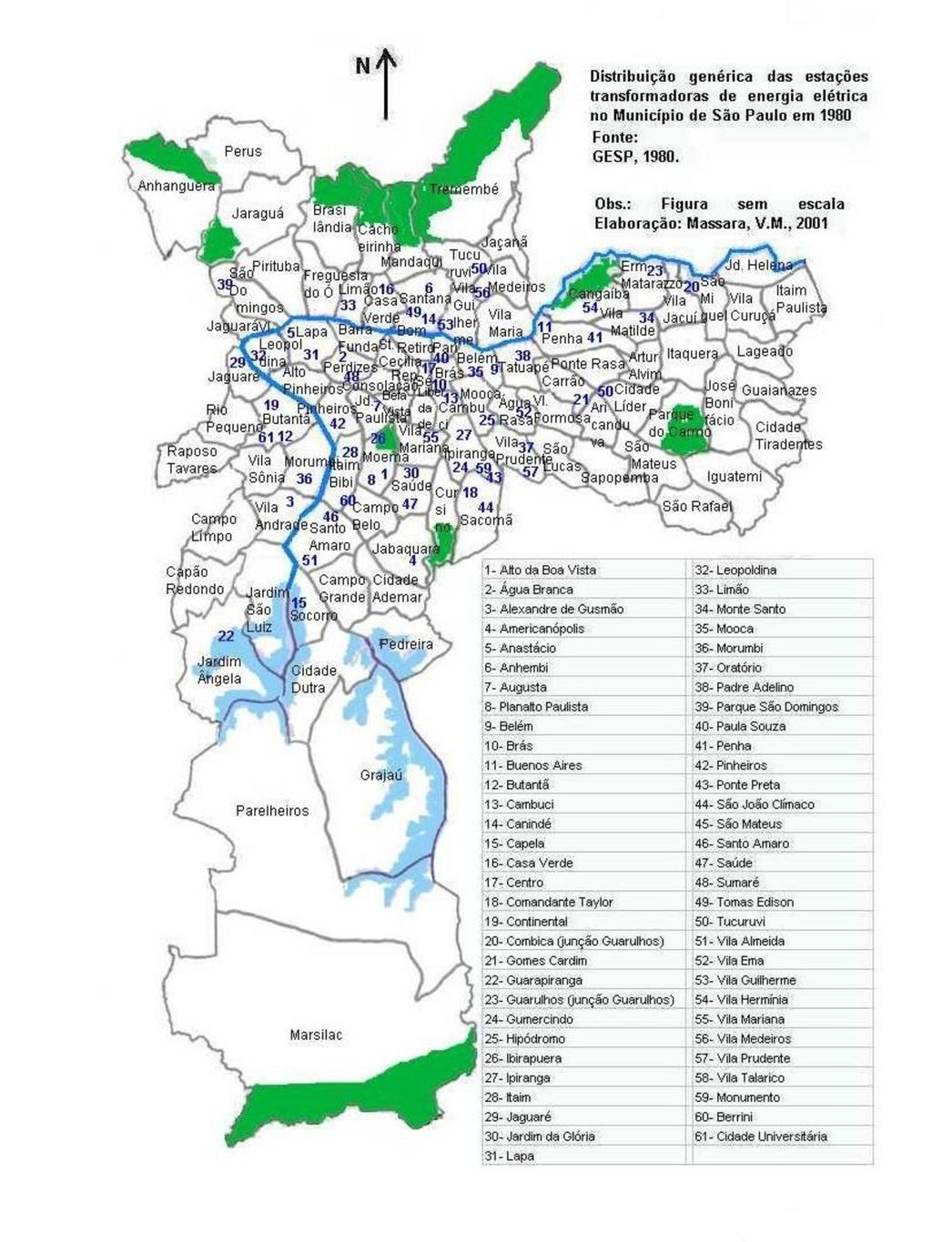
MANUFACTURING PLANTS

36
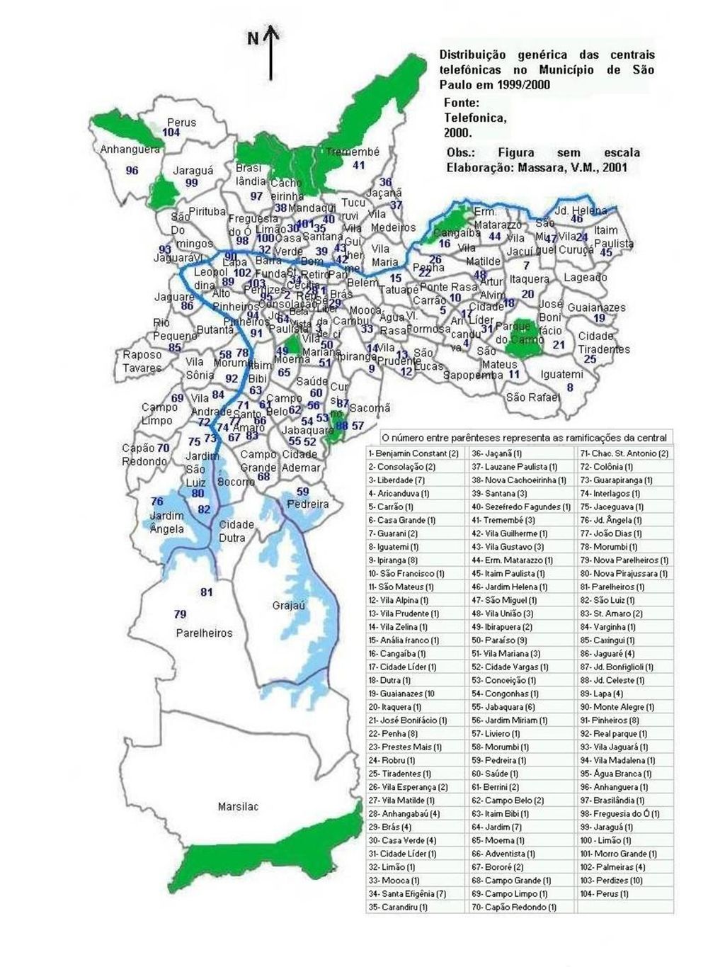
CENTRAL TELEPHONE

38
OPTICAL CABLE

40
Source: COMPANHIA DE SANEAMENTO BÁSICO DO ESTADO DE SÃO PAULO – SABESP. Rede de Abastecimento de Água, 1995. COMPANHIA DE SANEAMENTO BÁSICO DO ESTADO DE SÃO PAULO – SABESP. Rede de Coleta de Esgotos, 1995. NET BRASIL - Divisão NET SÃO PAULO. Lista de distritos servidos por tv a cabo.Área cabeada pela Net, Página da Internet. Endereço de acesso: PREFEITURA DO MUNICÍPIO DE SÃO PAULO, PMSP. Relatório da Gestão Ademar de Barros PMSP, 1961. ROLNIK, Raquel. A Cidade e a Lei: legislação, política urbana e territórios na Cidade de São Paulo. São Paulo, Studio Nobel Fapesp, 1997. SÃO PAULO (CIDADE) – SECRETARIA MUNICIPAL DO PLANEJAMENTO - COORDENADORIA GERAL DE PLANEJAMENTO – COGEP. Administrações Regionais, 16 volumes. São Paulo, PMSP, 1975. ______________- DEPARTAMENTO DE ILUMINAÇÃO PÚBLICA - ILUME. Pontos com pedido de manutenção / ligação no Município de São Paulo, São Paulo, 2001. ______________- DEPARTAMENTO DE PROCESSAMENTO DE DADOS - PRODAM. Atlas ambiental, 2000. SÃO PAULO (ESTADO) – SECRETARIA DE PLANEJAMENTO. Atlas Regional da Grande São Paulo – Mapa 11 - Energia. São Paulo, Governo do Estado de SP, 1980. TELEFONICA. Centrais Telefônicas no Município de São Paulo São Paulo, 2001.
 – SECRETARIA MUNICIPAL DO PLANEJAMENTO - COORDENADORIA GERAL DE PLANEJAMENTO – COGEP. Administrações Regionais, 16 volumes. São Paulo, PMSP, ______________- DEPARTAMENTO DE ILUMINAÇÃO PÚBLICA - ILUME. Pontos com pedido de manutenção / ligação no Município de São Paulo, São Paulo, ______________- DEPARTAMENTO DE PROCESSAMENTO DE DADOS - PRODAM. Atlas ambiental, SÃO PAULO (ESTADO) – SECRETARIA DE PLANEJAMENTO. Atlas Regional da Grande São Paulo – Mapa 11 - Energia. São Paulo, Governo do Estado de SP, TELEFONICA. Centrais Telefônicas no Município de São Paulo São Paulo,")
Apresentações semelhantes


 bilhões de pessoas não tem acesso a água de qualidade adequada ao consumo 2,4 (40%) bilhões de pessoas não tem acesso as condições básicas de.>")


.>")

